


Stowe-Area Hiking: Sunset Rock
Hike Details
- Skill Level: Easy
- Type: Short hike
- Distance: 1.0 miles
- Time: < 1 hour
- Climb: 200’
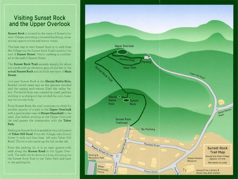
- Trailhead Location: The end of Sunset Ave, Stowe, VT 05672. From Stowe’s historic downtown village, walk down Sunset Street to the end (parking prohibited). The trail starts to the left of the road. For a shorter climb to the Upper Overlook, take School Street from Stowe’s historic downtown village and drive 0.4 miles. Bear left onto Taber Hill Road and continue for about 800’ to the parking lot on the left.
About the Hike
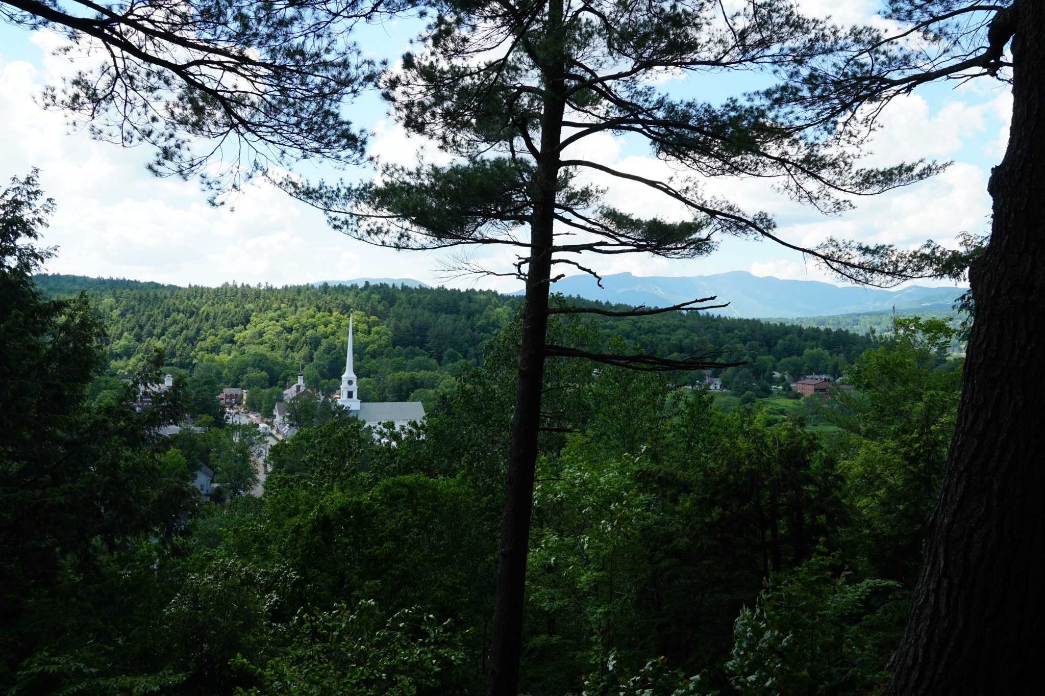
Sunset Rock is a short hike that starts in the heart of Stowe’s historic Village, providing a forested backdrop, recreational opportunities and scenic vistas. It’s the perfect place for a picnic with a view.
The best way to visit Sunset Rock is to walk from the Historic Village via the Sunset Rock Trail located at the end of Sunset Street. Visitor parking is prohibited at the end of Sunset Street, but ample parking is available behind the Stowe Community Church at the beginning of the Stowe Recreation Path and along Main Street.
The Sunset Rock Trail ascends steeply for about 200 yards with an elevation gain of 100 feet to the actual Sunset Rock and its birds eye view of Main Street.
 Just past Sunset Rock is the Glacial Kettle Hole, formed 10,000 years ago as the glaciers receded and the raging melt-waters filled the valley below. The kettle hole was created by small pebbles swirling in the whirlpool that eroded the rock, forming the circular hole.
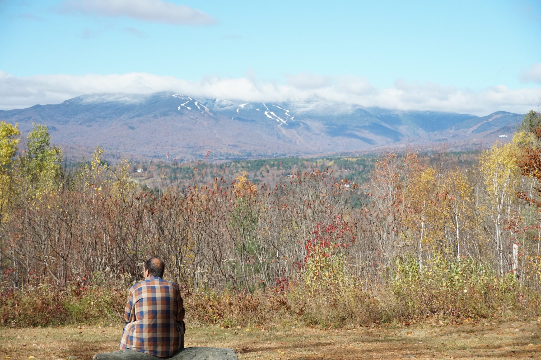
The trail continues to climb for another quarter-mile to the Upper Overlook with a spectacular view of Mount Mansfield to the west. Just before arriving at the Upper Overlook, the trail passes the intersection with the Taber Path.
For a shorter hike with less elevation gain, park at the Sunset Rock parking area on Taber Hill Road. From this parking lot, it is an easy quarter-mile walk along the Access Road to the Upper Overlook. The walk can be done as a loop, returning via the Sunset Rock Trail to the Taber Path and back to the parking lot.
Trail Map
Additional Hiking Resources
Flip through the full Stowe Hiking Guide, download it to your device or continue to browse other local hikes.